Sunday, February 20, 2022

The Rivers of Cornwall 4; The Camel, part 4

 This last section of our exploration of the Camel from source to sea, has a distinctively different character as it opens out into the estuary before passing Padstow and entering the sea in Padstow Bay. 

I will again put in the map by way of explanation.

In this last part, we go from Wadebridge to Padstow, with occasional deviations to the other shore of the estuary. This isn't an account of a single visit but draws from many over the past thirty years.


Re-joining the river and the Camel Trail which stopped on the south side of Wadebridge (see previous blog) we look back from the north side of the town as the Trail resumes. You can just discern the arches of the low town bridge over the river. Plenty of mud here at Low Water.


Looking downstream from the same place. The relatively new high-level bridge now by-passes the town on its way west.


It seems huge from underneath, as it strides across the saltmarsh below.


Just past the high level bridge. Careful scanning may well  reveal Snipe crouching in the salt marsh.


Extensive areas of mud are exposed at low water giving winter feeding ground for a large variety of wading birds including flocks of hundreds of Golden Plovers.

Maidenhair Fern, growing on Tufa, calcareous ooze which hardens in the air, is a substrate for this delicate fern. Usually established from gardens such as the abundant growth on the walls within the lime kilns at Cotehele Quay on the Tamar, it seems to be wild here and on a few cliffs on both north and south coasts in Cornwall.
Here it is growing in the first cutting made for the railway going out of Wadebridge. The Ivy protects it from the worst of the winter weather.


A party of birdwatchers looking across the mud towards Burniere on the opposite side. This is where the last main tributary enters the Camel, the River Amble. The excellent bird reserve on the Amble Marshes, Walmsley Sanctuary , discussed in a previous blog, runs up the shallow Amble valley behind Burniere.

This picture is taken from the hide at Burniere looking down the estuary at the areas of saltmarsh and mud flats pretty-well opposite the previous picture.


Going along the trail towards Padstow, high water gives a great expanse of water. Looking back to where we are coming from.


These are the spoil tips from quarries on the valley-side here. The stone was loaded onto boats at a jetty here, now long-disused. The well drained stony soils associated with this rubble give rise to a specialist flora of drought-tolerant plants including ferns such as Rusty-back.


The Trail goes over this bridge where Old Town Cove runs into the estuary. This is low water, showing the beautifully-constructed stonework on the banks supporting the bridge and embankment. Mullet will drift into the creek here at high water.  This is one of the rare road access points on this side.


Cant Hill is a prominent landmark on the opposite bank.


The next, Little Petherick Creek , we meet as we go on towards Padstow is wider as the old railway and now the trail has to cross it by means of a substantial iron bridge.


               Padstow, looking south. The Trail ends in the top left-hand corner.

Beyond Padstow on the far side is the dune area and popular holiday beach of Daymer Bay.


At some exceptionally low tides there are ancient beds of peat exposed at Daymer Bay. They are dated at 4400 years old.


With a small party of friends from the local Natural History Group in January 2015 we saw a number of sticks within these peat beds and also this length of tree trunk. This is a very vulnerable feature, liable to human damage as well as marine erosion.

The Camel reaches the sea beyond Padstow and the opposite holiday resort of Rock (reached by ferry)past the notorious Doom Bar, scene of many shipwrecks due to the ever-changing channel.  A local brewery has named its popular Doom Bar Ale after this treacherous moving sand-bar.
And finally, past the headlands of Stepper Point and Pentire Head the river enters the sea.

                                                                         Stepper Point.


Sunday, February 13, 2022

THE RIVERS of CORNWALL 4: The Camel in Winter, part 3

 Because the one-time railway and the subsequent Camel Trail which was made on the route of the dismantled railway, followed the River Camel for some miles along its lower reaches to the sea, the most accessible or at least visible, parts of the river and its valley can be seen by following the Trail.

The Wenford stretch described in the previous blog earlier this month  joins the trail where the Wenford branch of the railway joined the Bodmin to Padstow line at Boscarne Junction..

In this 3rd section, we follow the river along the trail as it runs NW from Dunmere to Wadebridge.

The Camel Trail is the red line. Boscarne Junction is puzzlingly not marked! It is just to the right of the Nanstallon Halt.


Boscarne Junction. The Camel Trail is behind the fence on the left and the river is a few yards downslope on the right. The white painted edge of the station platform can be seen on the far left. For some years a steam train has run passengers from Bodmin to this terminus at Boscarne. The photo is taken from the buffers. A few years ago the hugely popular Thomas the Tank Engine drew the short train from Bodmin to this point!


As we walked along the trail to the buffers the air was scented by a big patch of sweet Purple Violets growing on the bank.


The bridge over the river at Boscarne.


           Some of the riverside meadows in this stretch are unmanaged and rushy.

The next Halt was at Nanstallon,,,then...

                .........and now. The white building, a sign of the times, is a holiday let.

It was long believed that the Romans had no permanent presence in Cornwall but now there are known to be three Forts, the smallest at Restormel, the second largest at Tregear Farm near Nanstallon and the third and largest, still being excavated from time to time, at Calstock. 

The fort here, near Nanstallon was pretty close to the first fordable crossing nearest the coast. Roman artefacts had been ploughed up from time to time for years and in 1965 to 1969 the site was excavated and dated to Roman occupation from AD 65 till AD 79. Finds of coins, pottery and a broach are I believe now in the Museum in Bodmin. The rectangular banks surrounding the fort which occupied some 7 hectares, are now 'fossilized' in the present field banks.

Nanstallon's present claim to fame is the vineyard situated on the SW-facing valley side. Small beginnings in the days when English wines were rather scoffed at by the buffs, the Camel Valley sparkling whites are now Award Winners and the vineyard has expanded in acreage as well as café, tastings, and sales.

On the humbler side there is another café just at the side of the trail with a pleasant seating area under the trees which is very popular with the ever-increasing number of cyclists who use the trail nowadays. There are bike-hire sites at Bodmin, Wadebridge, Padstow and Wenford Bridge, with every imaginable type of bike available, from adults' to children's of all sizes, with towed trailers, baskets for babies, toddlers or dogs(!)

When I fist knew the Trail surveying the then still railway-ballast and narrow route, I would occasionally meet the odd local cycling in every day for their bread or papers. Now it is heavily-used and a heaven-sent off-road amenity.


Looking upstream from the bridge at Nanstallon. the woodlands and banks along the valley ae full of snowdrops. They seem to be making a particularly good show this year.


Look down from the bridge at Nanstallon at the low cutwater, and you can see the otter spraint. This is a popular scent-marking site for communication and territory-marking.


Looking down the valley. The river flows between small meadows, rushy patches and wet, largely willow and alder woodland.

The next accessible point to the river is where the train stopped again at Grogley Halt. This looks upstream from the bridge. The buff-coloured dead stems on the far bank are the remains of a thicket of Himalayan Balsam. Nearly thirty years ago when surveying, I found a few plants of this attractive but invasive alien, growing in a small side-stream a little way upstream from this point. I warned the local authority then that if they weren't removed the seeds floating down the stream and into the Camel Valley would pose a problem. I was ignored and in subsequent years sure enough they had a mega problem, having to send gangs of people in to hand pull and smash the plants.


The Halt at Grogley. It looks as if this was taken about 100 years ago?


Grogley now. Tony managed to blank out the friendly party having a picnic in the sun while on a round walk from Bodmin up the lanes to here and then planning to walk back up the Trail to Dunmere.


Downstream at Grogley, another favourite moth-trapping site in the past. We once saw a Flounder from the bank here, so I suppose the water can be rather brackish on a high tide?


Next access is at Polbrock. Here the valley gets narrower. The river has been meandering among small meadows but now the steep valley-sides close in, with an extensive coniferous plantation, Bishop's Wood,  on one side and steep deciduous woodland on the other. There are two substantial bridges here, this one across the river and the next within a few yards, across the Trail.
We saw Dippers flying fast and low over the water at each of these last three points.


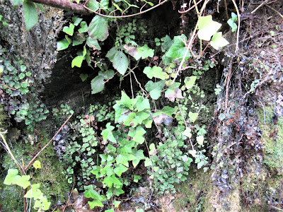
Bladder Fern. Found on a wet, vertical rocky face near here, this fern, very rare in Cornwall, was found in 2000 by a keen-eyed fern-lover. Glad to say it is still there.

At first glance it can be easily mistaken for any immature fern plant.


Close- up view of the underside of the frond shows why it is called Bladder Fern. The (immature at this time of the year) sporing bodies are round white blobs. which are diagnostic.


Climbing up the eastern side of the valley out of the dense woodland onto populated farmland we go through Sladesbridge where another major tributary, the River Allen, joins the Camel.
By now the valley has widened, with a flat bottom of wet grassland, now allowed by the environment agency to flood at high water on Spring tides.


Flood Meadows at Treraven, just before the end of this part of the Trail. The big flock of grazing geese are Canadas. There was one lone Barnacle Goose among them on this occasion.


Guineaport on the southern edge of Wadebridge. This is the end of this section of the trail. There is a small parking area here, overlooking the now fully tidal stretch of the river. This is looking upstream to Egloshayle across the river from Wadebridge . Yuo can cross the river from the far side either by a footbridge or the long, low 15th Century road bridge within the town.
There is a rudimentary hide just upstream to the right of this picture from which to look at the wet floodable meadows of Treraven for birds of winter interest such as Green Sandpiper, or Water Pipits.

PS Erratum alert  by a sharp-eyed reader of the previous blog. The potter at Wenford Bridge was Michael Cardew. Bernard C. lives in our village and is no relation of the potters!


Sunday, February 6, 2022

RIVERS OF CORNWALL 3: The River Camel in Winter, Part 2

 This second part of our exploration of the River Camel in Winter took us from Wenford Bridge, downstream to Dunmere Bridge about a mile north of Bodmin. Here the river bends sharply northwest towards Wadebridge and Padstow.

The now very popular Camel Trail, runs from Bodmin to Padstow, following the Camel and was constructed on the old railway along the same route which was closed and dismantled in 1983. The railway had been used for freight and passengers. A branch line went from Dunmere north to Wenford Bridge and this line was used solely to carry sea-sand from the Camel Estuary to farms in the hinterland of the coast. The return journeys carried China Clay after processing at Wenford, and granite from the de Lank quarries on Bodmin Moor.

 It's this branch that we followed a few days ago. It is about 9kms long, and is now a cycling and walking track which follows the river and gives access to it at intervals.

        Camel Trail noticeboard at the Wenford Bridge end of this branch of the trail.

 Wenford Bridge looking upstream. This is a Grade 2 listed structure, one of six listed on the River Camel.

This Pottery was started in 1939 by the famous studio potter, Bernard Cardew and continued by his son Seth until he moved in 2005 and sold the premises to another pottery.  One of the reasons for this location was the access to China Clay which was processed nearby from clay extracted from the rotting granite on the moor at Stannon.


You can see the narrow yellowing path through the grass where otters take a short cut to avoid going upstream against the current when the river level is high. It's avoiding the river in flood and feeding up this little side-stream.

The next crossing and access to the river is at Poleys Bridge a mile or so downstream.

                  Poleys Bridge looking upstream. You can see the steel bars used to strengthen the bridge.

This is where the extensive China Clay works  known as Wenford Dries were built with  the railway alongside to take the clay to ships at Padstow.


The Wenford Dries when still working, until 1978.


China Clay slurry was piped over 7kms from the China Clay pits at Stannon into a series of settling ponds behind this building. When most of the water was drained off the thicker material was loaded into a long building with underfloor heating. The furnace was down the far end of the building to the right and the hot air was drawn up  below the tiled floor by the chimney on the left.

The dry china clay was then shovelled into the railway trucks alongside and taken to Padstow.


The very long building of the dries is now becoming overwhelmed by woodland and was being vandalized so it's all fenced off now.


                                       One of a series of settling ponds behind the dries.

Going downstream, the river winds between small flat meadows and wooded valley sides, We set the moth trap just here below Poleys Bridge in late summer a few years ago.

As usual in Britain, the seasons merge. We saw this clump of the late summer/autumn fungus, Sulphur Tuft, quite unscathed by the recent sharpish frosts.


Sulphur Tuft toadstool.


Ivy berries don't really ripen till well on into the winter, giving a valuable food for the thrush family and pigeons.


At the same time, signs of spring are around. The wet valley woods along the Camel have abundant clumps of snowdrops in places. These aren't native, but are long-naturalized.


and Lambs tails are always a welcome sight.

Merry Meeting is a knot of five lanes and two rivers so it's well named! This is still the Camel, but just upstream it's joined by the de Lank river, the uppermost of the three main tributaries of the Camel. This bridge is called Tresarrett Bridge.

The lane follows the course of the river nearby, going up and downhill, winding its way though a tangle of woodland.


Helligan Wood. This is private so the river, largely obscured by trees, is inaccessible apart from those with the fishing rights.


               Definitely KEEP OUT!


Next is the extensive Shell Wood, a coniferous plantation managed  by the Forestry Commission. I see now a large area on the valley-side has been clear-felled and re-planted with deciduous species. The woodland track here is another favourite moth-trapping site.

The Trail follows the river through attractive pastoral country until it reaches Helland Bridge, the first of the Camel bridges not to have been completely swept away by the great flood of 1847 (mentioned in the River Inny blog a few months ago.)

But oh dear! Time or increasingly heavy vehicles, have caught up with it and we found ROAD CLOSED and extensive repairs in progress.


                                                     Helland Bridge looking upstream.

               There's an ominous bulge on the parapet here. More work to be done yet, I think.

The trail continues sometimes fairly close to the river, sometimes further up the valley-side. There is almost unbroken oak woodland near the river but more grazing land up-slope. This branch of the trail is narrower and less-used than the main Bodmin - Wadebridge - Padstow sections.


Looking across the Camel valley as we approach the next crossing at Dunmere. The valley is densely wooded here.


Flowering as early as January, the Dog's Mercury is always a harbinger of the new season's awakening.


At Dunmere Bridge where the main A309 road runs from Bodmin to Wadebridge, the river makes a sharp turn from the SW to the NW and nearby the Wenford Railway joins the track from Bodmin to Padstow, and the Camel Trail can be followed either back to Bodmin or on down to Wadebridge and Padstow.


The Bridge at Dunmere, taking heavy traffic. We chose to finish the second stage of the walk here. All four of the stages we will do it in are very different in character, adding to its interest.