New Wetlands in the Lower Tamar
The Tamar, which forms most of the border between Devon and Cornwall, is a very ancient river. Physical geographers tell us the river was in place 70 million years ago, winding its way south, and as the land gradually rose in the area where Gunnislake is now, the river slowly eroded its way down through the rock, retaining its bends, known as ‘incised meanders’ which are typified by the steep rocky cliffs towering above the river banks in places.
 |
| The map of the lower Tamar from Gunnislake to the Tamar Estuary. Scale 1cm to I km. |
Below Cotehele the valley widens out and the low-lying riverside meadows, known locally as ‘Hams’ are liable to flood. To safeguard property and retain the river meadows for grazing, a long levee was constructed in 1850, along the river bank on the Cornish side from Halton Quay to above Calstock, a length of getting on for three miles. The river is tidal all the way up to the weir just downstream of Gunnislake. At intervals ditches drain the meadows through culverts under the levee by means of tidal flaps. These allow water to run into the main river at low tide and closed as the tide came in so no water ran back into the meadows.
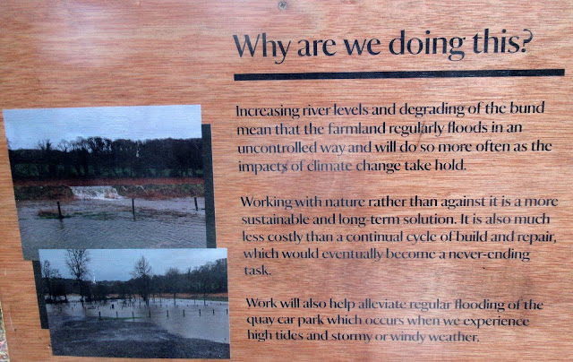
Some 15 years ago plans were being thought out to cut the levee in places to allow some of the low-lying meadows on the Cornish side to flood at high water and times of heavy rainfall, thus alleviating the risk of flooding Calstock and other low-lying properties in the lower reaches of the valley. At the same time this would enhance the habitat value by increasing the extent of wetland.
The scheme proceeded slowly. Vehement local opposition to the plan to flood Haye Marsh, an area downstream of Cotehele caused that project to be abandoned.
In October this year, a breach was made in the levee above the Cotehele car park and a long narrow meadow between the riverbank and a woodland on the rising valleyside, up as far as the river cliff downstream of Calstock was opened to inundation. This land belongs to the National Trust and the public footpath runs through the base of the adjacent woodland, so views can be had through the trees, of the newly-developing wetland.
 |
| There are several explanatory notices about the wetland project at the side of the woodland footpath at Cotehele. |
 |
Looking across newly flooding wetland upstream from the public footpath through the Cotehele woods above the car-park. So far, there aren't any places from which to get more than a glimpse. You can see the cut in the riverbank towards the left of the picture.  A Little Egret quickly appeared and a Kingfisher was sitting at the side of the cut when we looked in October. |
 |
| The path along the top of the levee, walking south towards Calstock. The Tamar is on the left of the path. |

The matter was finally resolved when the Environment Agency agreed to construct a walkway spanning the breach in the levee, so at last, work went ahead.
Towards the end of 2020 extensive excavations were dug in the meadow to be flooded in order to build protective bunds at the lower end to protect the village playing and recreation fields, car park and low-lying part of the village; and at the upper end to protect the local sewage treatment works. These excavations would form shallow ‘scrapes’ or pools. The whole of this area was fenced off and declared a Nature Reserve with no public right of entry.
 |
| Driving piles many feet deep into black silt to make footings for the walkway when it crosses the cut to be made in the levee on the left of the picture. |
 |
| Pools already forming in the scrapes at the southern, Calstock end of the area to be flooded. This was in October '21. |
 |
| Looking east across the flooding scrapes in October '21 |
Work proceeded in 2021 to construct the walkway before the cut was made in the levee. Until the early part of October, the levee path remained open to the public until the final stages of construction, and as I write, on November 12th ’21 the breach is due to be made and hopefully the walking route will be resumed.
Meanwhile interested people, both local residents and those from further afield, are watching the development and future changes with interest. The shallow pools soon attracted water fowl. Green Sandpipers and Common Snipe could be seen regularly throughout the late summer/ early autumn period, together with numerous mallard and Teal. Black-headed Gulls, with the occasional similar Mediterranean Gull among them, appeared from time to time.

Drake Teal

Green Sandpiper, showing conspicuous square white rump when it flies.

Black-headed Gull. They almost invariably lose their black head in the winter and instead just show a black spot behind the eye. Black tips to the primary wing feathers show clearly.

Mediterranean Gull. Compare this with the Black-headed Gull above. In winter it also loses its black head and instead has a grey smudge behind the eye. Importantly, there are no black tips to the primary wing feathers.
This gull is being seen more often these days. It breeds on the north Brittany coast so hasn't got all that far to come
The extensive soil disturbance has initially given rise to a vast population of docks and thistles, but these will reduce in the course of the inundation and I understand there are plans to hasten the spread of the riverside fringe of reeds across the new wetland with more planting of this species. The gradual changes in the flora and fauna in this area will be monitored, and interesting to see, both at Calstock and Cotehele.
Latest news:
The cut in the levee was made on the 13th/14th November at low water, neap tides, to minimise the initial surge of silt flow. Only distant views were possible when we went to look at high water on 14th, but the area will be watched closely as it develops.
There is a Facebook page about the project at Calstock :
Calstock Wetlands Bird Watchers' Group.

 |
| The first morning after the breach in the levee. The first picture is looking inland towards the area which will be inundated at high tides. The lower picture is looking back towards the river. (Many thanks for photos by Peter Thompson.) I follow this bog: |