 | |
| The Inny is one of the main tributaries of the Tamar. |
Issuing from several springs around Davidstow on the north-eastern edge of Bodmin Moor, the Inny runs for some 30kms through a wide valley until it joins the Tamar in woodland at Inny Foot.
 | |||
| Marshy ground on the edge of Davidstow airfield hides one place which can be claimed as a source. |
Marsh Woundwort with strongly smelling leaves when crushed,grows prolifically in these marshy areas. It is a very popular plant for insects.
 |
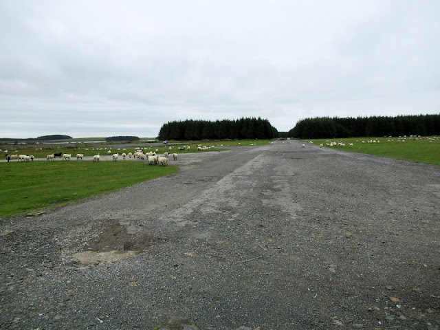
As we drove towards Davidstow where there are several little springs which give rise to the river, there was a dark pall of low cloud and mizzle. The wartime aerodrome of Davidstow, at 960ft was the highest war-time airfield in Britain but was frequently not operational because of the low cloud.
 |
| Crowdy Reservoir, just west of the aerodrome. Dammed in 1973 this is a 170-acre stretch of water worth looking at for water birds from the hide at the edge of the right-hand plantation. |
 |
| Looking south across the airfield, the square block of the ruined control tower can be seen on the horizon. |
Camomile with its feathery fragrant leaves, grows prolifically on the short turf and flowers late in the summer.
Ruff in winter plumage, visiting Davidstow aerodrome .(photo Sep.2016)
 | |
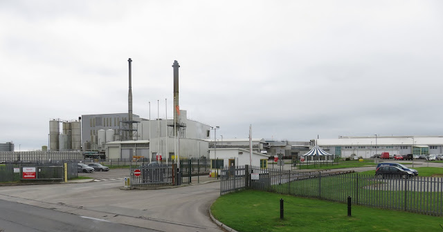
| Davidstow's main claim to fame nowadays is the cheese factory, said to be the largest in Britain. It is home to Cathedral City (odd name!) Cheddar. |
Back in the 'fifties before I left college I was offered a laboratory job here. In those days it belonged to Ambrosia and they made tinned rice pudding. I turned that down as I was also offered a job running the Quality Control lab in the Aplin & Barrett creamery at Frome in Somerset. This was more attractive as it was a bigger creamery making a wider variety of dairy products under the name of St Ivel.
The modern cheese factory at Davidstow, now owned by Dairy Crest, is unrecognizably bigger these days.
 |
| Near the church is St David's holy well, one of several springs, more sources of the Inny. The cheese factory is said to draw its water from this well. |
 |
| A little south of Davidstow the streams converge to give a more convincing flow of the Inny. |
 |
| Meadowsweet. |
Soon the river cuts itself a deeper valley and the lane to the next crossing runs steeply downhill among small meadows and woodland.
 |
| The next crossing is at Treglasta Bridge |
Looking upstream at Treglasta where we watched a pair of grey Wagtails .
The Sycamores by the bridge showed the familiar 'Tar Spot' fungal growth on one tree and the less common pink spots of another fungus on another tree.
 |
| Continuing south-west the river runs under Tregulland Bridge |
 | ||
| A rushy meadow just beside the bridge with a fringe of beeches on the horizon. |
Five different ferns were growing in the stonework of the bridge. Above is the pretty little Wall Rue and to the right, a Hart's Tongue Fern.
There was also Maidenhair Spleenwort (left) and the other two species were Lady Fern and Green Male Fern.
Just upstream a farm had made a nature trail around a large ornamental lake with cultivated Water Lilies. It was surrounded by an electric fence, maybe to keep Otters from marauding their fish?
The wide valley continued past rounded sheep pastures on the right and several rocky, scrubby outcrops on the left which shelter a restored Holy Well. I plan to do a future blog about our various Holy Wells so I'll leave this one for the time being and go on to the next crossing just beyond St Clether.
It's noticeable along the whole length of this river that the villages are up-slope of the river, which has a reputation for rising very fast following heavy rain, but levels falling again just as rapidly. So we by-passed Hallworthy with its weekly cattle market, St Clether and Laneast with 15th Century churches with pinnacled towers and Polyphant where an unusual Serpentine-like stone has been quarried and used extensively in the past for ornamental details in the local churches.
Instead, at many of the
crossing points there are what used to be mills, now either disappeared
or 'done up' making attractive (flood-prone?) dwellings .
 |
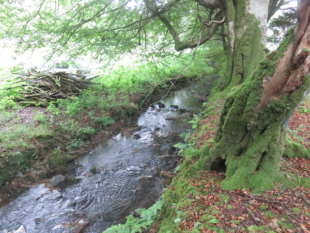
It's strange that, in a county where Beech isn't a native, that there was such widespread planting of it between one and two hundred years ago. Large trees have grown up in rows, in hedges and as solitary specimens. It is well established now and grows readily from seed.
Alongside the path were clumps of Marsh Woundwort and Devils-bit Scabious which were being visited by numbers of Silver Y moths, and various Bumble Bees and Hoverflies.
 | |||
| Looking North across the valley from the low ridge between the Inny valley and that of its main tributary the Penpont Water which is running parallel behind us. |
 | |
| The next bridge downstream, the same design as the previous one upstream. This bridge, at Gimblett's Mill, was completely swept away by 'a great wall of water' in 1847 and was rebuilt. |
Ivy is flowering now and is a rich source of pollen and nectar for insect visitors. The bees were collecting bright orange pollen from this clump.
The pretty little Ivy-leaved Toadflax grows between the stones of the bridge and it's still flowering.
None of the roads follow the course of the river so to get access we repeatedly looped away up the valley sides and then wriggled down narrow, often wooded lanes, to get to the next mill or river crossing.
The final stretch of the river will follow in Part 2 when the forecast unsettled weather system has passed.


No comments:
Post a Comment