 | ||||
| I'll repeat this map. This section, part two, follows the Inny from where it is joined by the Penpont Water SW of the A30 trunk road. |
 |
| Autumn was upon us as we continued our travels. The clear night skies gave heavy morning dew and Orb Spiders were constructing their nightly works of art slung among tussocks of Cocksfoot grass. |
Ash Die-back is showing clearly now. There seems to be a random scatter of trees with sparse ragged growth and some bare branches; some trees are in full leaf and apparently un-affected, while others, mostly young individuals, are ghostly grey and completely dead. Is this showing that we haven't yet seen the full effects of this devastating disease, or are we seeing variable degrees of immunity?
To continue the gloom for a moment, we are noticing this year that beeches, so common around east Cornwall as I mentioned in Part One, are looking brown and burnt as if cold or salty gales have affected them. But we haven't had such gales recently and it seems to be the vast majority of beeches affected, not just those in more exposed places. It looks as if we'll be denied our usual glorious spectacle of sun shining on golden autumn colour, contrasting with the elegant black branches. I haven't heard of anything malign....
 |
| Silver Y moth. The reason for its name is obvious! |
Walking in the meadows and paths among the rags of the summer flowers, we frequently disturb Silver Y's. These day and night-flying moths can be very abundant. They come from the Continent in Spring and will produce a home-grown brood in the summer, which is flying again now. They will come to light, but seem on the whole to be more interested in nectaring. They will hibernate as adults here and some manage to survive our winter. I inadvertently disturbed one this January, hidden among the dead leaves at the base of a clump of border plants. It was very dozy and I hurriedly covered it up again.
Tr
 |
| Trekelland Bridge |
| This is the first crossing of the river below the A30 trunk road. It is narrow and these days frequently knocked about by the increasingly heavy traffic. It was the only bridge to survive the Great Flood of July 1847 which swept away most of the bridges across the Inny. I will add the vivid account of this disaster at the end of the blog. The river at this stage is developed into a valued fishery mainly of Sea Trout and the fishing rights are held by various local clubs. |
 | |
| The valley is now considerably bigger with both a lot of woodland (a lot is conifer plantation replacing old oak woodland) and some arable. |
 |
| An unexpected sight of a French-looking field of Tournesols but with the unmistakable outlines of Brown Willy and Roughtor, high spots on Bodmin Moor, on the southern horizon. |
 |
| More ancient beech trees planted probably a couple of hundred years ago, along the lanes on the way to the bridge at Trecarrell Mill. |
Gold-ringed Dragonflies are still zooming up and down the lanes.
Otherwise this can happen. My kids were at junior school with the children who lived in this cottage. When the family moved out, the roof decayed and then fell and this has all happened in the last forty years.
Apparently it was once a Toll Cottage on the turnpike road from Saltash to Launceston, replacing the old main road to the east at Beales Mill.
The hedges are still draped with Greater Bindweed. This flower is handsome enough to grow in a garden if it wasn't for its invasive roots and over-enthusiastic smothering growth, making it a pernicious weed as I know to my cost.
Honeysuckle is still flowering too, giving nectar to late-flying insects.As children we used to pull the flowers off and suck out the nectar from the base of the tube, just as we did earlier in the year with the flowers of White Dead-nettle.
 |
| The valley just above the last crossing at Beales Mill. Heavy rains will make the Inny flood where it can at any time of the year. |
On the last stretch, before the Inny joins the Tamar, it runs though grazed and less-grazed meadows with tree-lined banks.
 |
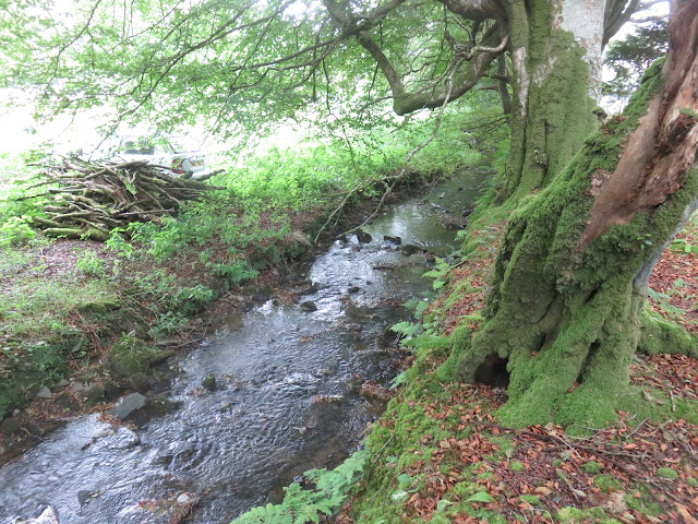
| Otters would love this tangle of hidey-holes. |
Otters will scrape up 'sandcastles' at the water's edge to mark territory.
Another sprainting site is on prominent features such as this boulder. The distinctive musky smell is long-lasting and is a contact and territorial marker.
The river leaves the meadows and enters an extensive area of woodland. Once ancient oak woodland, it is now considerably planted with conifers. There have only been three owners here. In the Middle Ages the woods belonged to Tavistock Abbey. Then the Russell Family(who became Earls and Lords Bradford) and now Tilhill Forestry manage the woods for the present owner.
 | |
| The rather pathetic remains of Herne's Oak, thought to be about five hundred years old and a relic of the old oak woodland beside the river. |
In the eighteen hundreds, the then Duke of Bradford laid out ornamental carriageways through the woods and planted specimen conifers, Rhododendrons and other cultivars. He ran two leats from the river to supply water to two lakes, now silted up although one, on the right bank, called Inny Mere is still shown with open water even though a stand of Balsam Poplars was planted in the drained lake bed about fifty years ago. The fringe of Royal Fern along one bank of the lake seems now to be overwhelmed by bracken, the Gunnera planted by one of the leats has gone since the 1970's but a big spread of the wet-loving Japanese Heliotrope planted at the head of the mere is still there.
Tilhill Forestry had plans to restore Inny Mere and felled the Balsam Poplars but nothing else has happened.
 |
| The large butterbur-like leaves of Japanese Heliotrope(Petasites japonicus) at the head of the mere. It has large heads of white flowers early in the spring but dies back completely in winter. |
Scuffing through the dead leaves in the woodland tracks we saw Yellow Pimpernel(above) and Self Heal (right) still in flower and Speckled Wood butterflies were still on the wing, commoner than they were this spring.
Tony gathered a few Hedgehog Fungus (Hydnum repandum) for his tea. Note the unusual spiky underside of this toadstool, unlike the usual gilled arrangement.
 |
| Fording the Inny just before it joins the Tamar. The narrow footbridge a little way upstream is long gone. |
 |
| Modern-day exotics! Himalayan Balsam is abundant in places along the riverbank now. It didn't occur here when we first knew the river fifty years ago. |
 |
| Journey's end. The Inny quietly joins the Tamar |
 |
| The enlarged Tamar runs down to the sea. |
I am putting in the account of the Great Flood of 1847. Extreme weather events are nothing new!
(Tamar/Inney)....Gimblett's Mill has a quaint bridge with six square openings, rebuilt after the flood of 1847. "
"River Inney....The latter [Trecarrel] was once a moorstone bridge but it was swept away in [the flood of] 1847.
" Trekenner Bridge below Trecarrel is now deserted....The three little arches (2 feet in span) were broken by
the flood of 1847 but the piers, and cutwaters of the 16th century bridge remain. " "Beals Mill Bridge, the
lowest on the Inney, ....has had its 2 arches (13 feet span) rebuilt after the flood of '47.... "
(Camel) "Gam Bridge, spanning the united streams [of the River Camel] is named in 1613, but the old bridge
was swept away by the great flood in 1847 and has been rebuilt with 7 square openings instead of arches. On
16th July, 1847, a waterspout burst on Davidstow Moor, the watershed where the Camel and Inney (despite
their opposite destinies) take their rise. The water collected in the valleys and forced a passage in two
directions, down the Inney and the Camel. A wall of water from 12 to 18 feet above the usual level of the river
swept down the Camel Valley carrying everything before it. It was a hot sultry afternoon with a clear sky, and
men working in the fields at Gam Bridge could hardly believe their senses when they saw the water
approaching them. Gam Bridge stayed the flood for a moment but soon gave way and the infuriated water
attacked Wenford Bridge with a regular bombardment of tree trunks and other things plundered from the
meadows. A mineral train happened to be in the station at Wenford Bridge, and the driver with great presence
of mind drove his engine at full speed down the valley shouting to the people to leave the riverside. He was not
a moment too soon. Wenford Bridge broke beneath the strain and Poleys Bridge followed suit. Tresarret Bridge
was swept away. Helland Bridge showed that the mediaeval bridge builders knew their business, for despite
the depth and narrowness of the valley, the waters failed to break it, but rising above the parapet, swept on
and brought their battery of trees and hayricks against the ancient bridge of Dunmeer. This was soon swept
away together with the railway bridge by its side. A train was approaching the bridge at the moment of its
destruction but the driver was able to bring it to a standstill. The lowest railway bridge at Pendevy floated gaily
down stream and would have done much damage to Wadebridge had not men in boats secured it with ropes
and chains. When the flood subsided, it was found that the valley from end to end had been devastated. All the
bridges but Helland and Wadebridge (the two oldest) were in ruins, and for 12 months remained impassable.
Many years later pieces of hay, straw and mud could be seen in the branches of trees at Dunmeer 20 feet
above ordinary water level."
Rivers Camel, Inney and Allan. Rain fell in this area from 10am to 6pm (mostly in the morning). Dunmere village
(below Bodmin) and the whole valley below Dunmere Hill were flooded. Dunmere Bridge washed away as was
the new 40 foot high railway bridge. There was 6.25 feet of water in the kitchen of Mr Allen's mill at Dunmere.
(Valency) Boscastle: "The village was previously hit by floods in 1847, 1957, 1958 and 1963...."
RCG reports Camelford; One of the most violent storms of thunder hail and rain in the last 50 years
commencing 10 in the morning to 6 in the evening. The Camel rose to a great height, houses were flooded and
inmates had to escape to upper floors. The bridge at the eastern entrance to the town survived. An immense
body of water came down what is called the ‘Outground River’ which flows into the Camel just below the town
and which is fed in turn by the Longcarn River and the Tiland River. The Longcarn branch flows over a bed of
loose granite and on this occasion it tore up large blocks of stone ‘impelling them onward with a roar list
distant thunder’. One block upwards of 10 tons was torn from its site and forced onward for a considerable
distance. The Tiland did not rise so high as the Longcarn but still carried everything in its progress. At
Tregoodwill it carried away the bridge and the gable end of a house. Below the junction with the Camel it
Western Times 10
Jul
carried away every bridge to Wadebridge. No lives were lost but one young man was caught in the approaching
flood and climbed a tree where he had to remain until the flood abated. The highways in the parishes of
Lanteglos and Advent suffered severely; bridges were carried off with much loss of crops and agricultural
implements. Wenford Inn and stables filled with water. It is supposed that the storm and flood was confined to
within 5 miles of Camelford and only the Rivers Camel, Inney and Allan were affected. Three county bridges
were destroyed on the river Inney.
Bodmin/Dunmeer: Dunmeer was under water and an observer reported ‘the whole valley was a sea of roaring
foaming turbid water’ Dunmeer bridge was washed away as was the new railbridge downstream a one arch
bridge 40 feet high, 10 minutes later. Only a small part of Holland Bridge was washed away and at Wenford
bridge only the parapets were carried away. Allan’s Mill at Dunmeer the water was 6 ½ feet in the kitchen and
people were resuced from upstairs. Stones of many tons have been washed on to cornfields. In the
neighbourhood of Bodmin there was no rain for the day except a shower or two. About 50 years ago a similar
catastrophe occurred but the water was not so high by 4 or 5 feet (other reports of 3 feet) and no bridges were
destroyed. The observer noted that the Camel is fed by the Allan as well as the upper Camel but only the latter
was affected. ‘The Allan had not a drop more than the ordinary’
A mill and house at Holland bridge were washed away and at Wadebridge an Inn which stands 20 feet above its
general level was flooded to one foot depth. The wooden Ruthern bridge was carried downstream and laid on
a hedge and the bridge at Polbrock was carried off three miles downriver.
The neighbouring county was visited by a violent thunderstorm. The flood carried away three bridges between
Wadebridge and Bodmin. The bridge at Davidstow has been carried away.
I follow these Blogs:
( A new one from Tony:
www.downgatebatman.blogspot.com
Also:
www.northcornwallnaturalist.blogspot.com
www.musingsfromhigherdowngateandelsewhere.blogspot.com


